Ma Pi Leng Pass: The Ha Giang Loop's Legendary Cliff Road
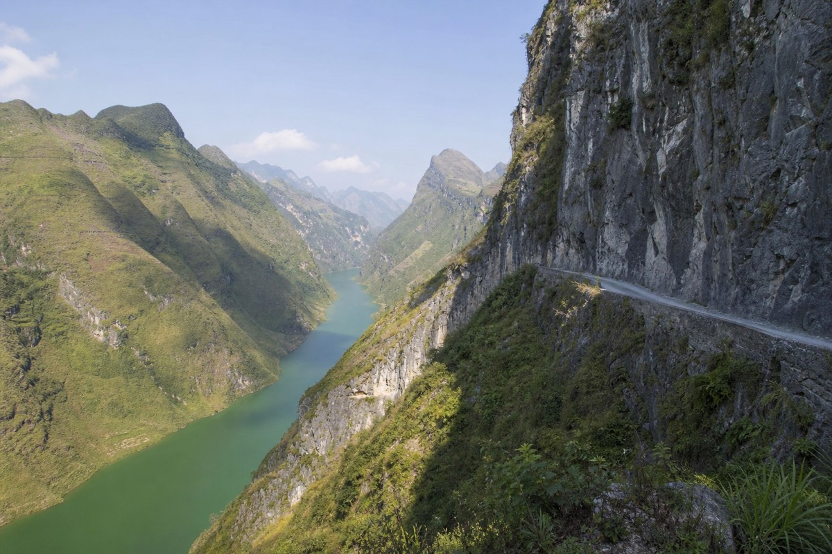
Every rider who finishes the Ha Giang Loop points to the same stretch of road when you ask what stuck with them. Ma Pi Leng Pass is a narrow shelf of asphalt carved into a limestone wall between Dong Van and Meo Vac, with the Nho Que River running turquoise almost a kilometer below. It's the reason people fly to northern Vietnam for a motorbike loop instead of a beach.
Booking choice: Ride through Dong Van and Ma Pi Leng, take the Nho Que boat trip, then spend the second night in Du Gia. Check dates for the 3-day Easy Rider ↗
Your selections need confirmation. Adjust them in the trip comparison below.
In brief: Match the named stops and overnight towns to your plan. Confirm the riding format, travel days and inclusions before choosing a departure.
What Is Ma Pi Leng Pass?
Ma Pi Leng Pass is an 18-20km mountain road cut into a sheer limestone cliff between the towns of Dong Van and Meo Vac in Ha Giang province, running roughly 1,500 meters above the Nho Que River gorge at its highest points. Locals call the road Con Duong Hanh Phuc, the Happiness Road, and the name has stuck for good reason. There's no other stretch on the entire 350km Ha Giang Loop where the drop, the rock, and the river line up so dramatically in one view. Riders and jeep passengers alike tend to stop talking for a minute the first time they round the bend and see the gorge open up.
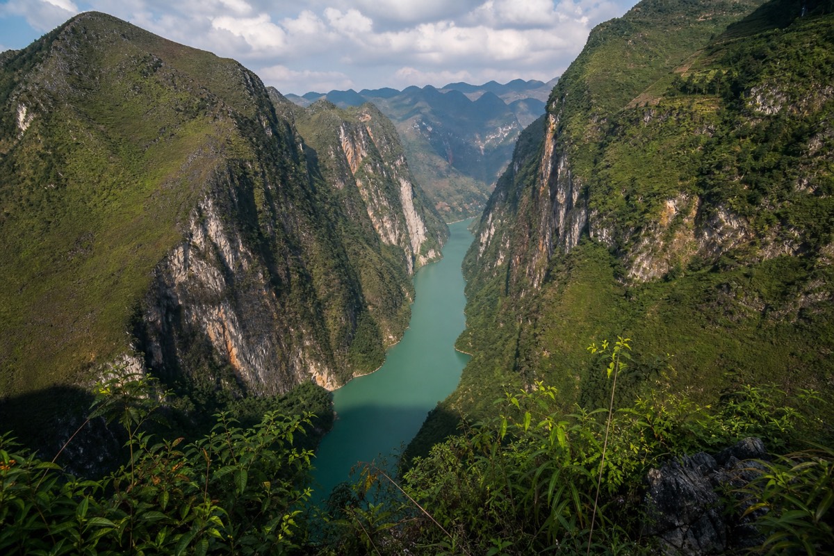
The pass sits inside the Dong Van Karst Plateau Geopark, Vietnam's first UNESCO Global Geopark, and it's the single most photographed and most cited landmark on the loop. If you've seen a photo of Ha Giang before ever booking a trip, there's a good chance it was taken here.
How Do You Get to Ma Pi Leng Pass?
Ma Pi Leng Pass sits about 190-200km from Ha Giang city by road, reached by riding north to Dong Van first and then continuing east toward Meo Vac; there's no shortcut and no way to reach it without doing at least two days of mountain road first. Most riders cross it on day two or three of a loop, after overnighting in Dong Van. It isn't a side trip you bolt onto a short itinerary; it's a fixed point on the route itself, which is part of why how many days you need for the loop matters so much when you're planning around it.
| From | Distance | Typical riding time |
|---|---|---|
| Ha Giang city | ~190-200km | 2 days (via Quan Ba, Yen Minh, Dong Van) |
| Dong Van | ~20km | 45-60 minutes, more with photo stops |
| Meo Vac | ~18-20km | 45-60 minutes, more with photo stops |
| Yen Minh | ~50km | 1.5-2 hours |
Because the pass connects Dong Van and Meo Vac directly, almost every counterclockwise loop itinerary crosses it on the same day riders leave Dong Van's old quarter behind and head for a night in Meo Vac. Check the full route explained with map and stops for exactly where it sits against every other stop.
Why Do Locals Call It the Happiness Road?
The name Happiness Road refers to the whole highway connecting Ha Giang province's district towns, built by hand across the late 1950s and into the 1960s by thousands of volunteer laborers, many from local H'mong, Tay, and other ethnic minority communities, working with basic tools against solid rock. The Ma Pi Leng section was the hardest part of that project by far. Crews had to work along a near-vertical cliff face with almost no machinery, blasting and chiseling a narrow shelf into limestone that drops straight into the gorge. The road took years to complete and is remembered locally as one of the defining feats of the region's modern history, which is why the name carries real weight rather than reading as tourist marketing.
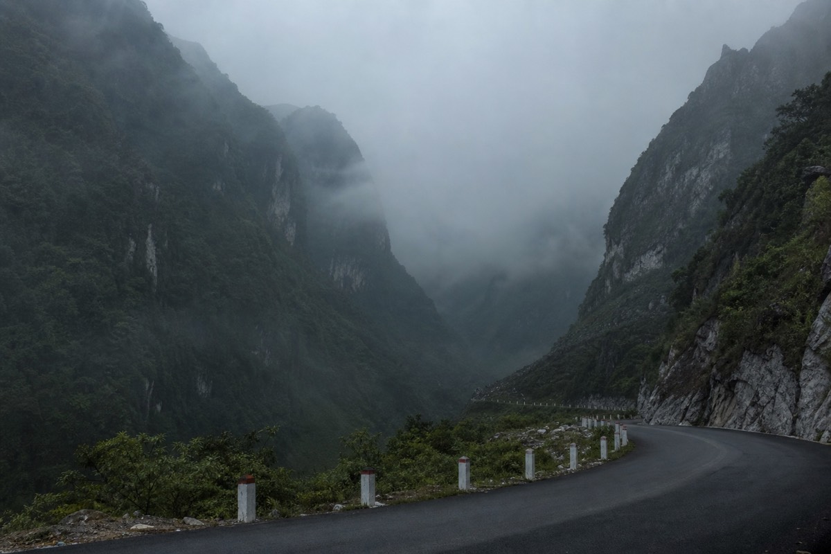
Riding it today, in a matter of minutes on a rented Honda, it's worth remembering that the road under your wheels represents a genuinely difficult, multi-year construction effort by people who had no bulldozers and no safety harnesses. That context changes how the cliff face looks.
What Does the Road Itself Look Like?
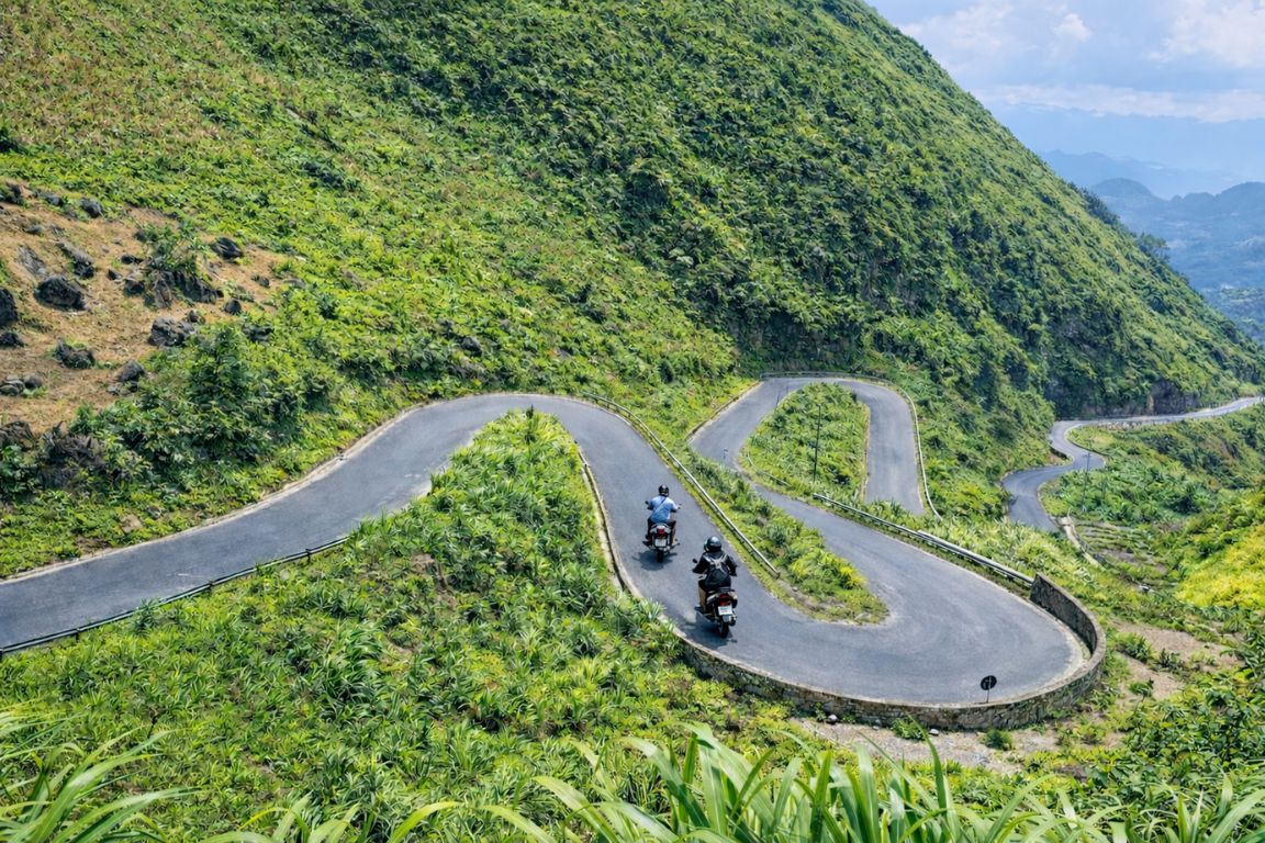
The pass is a two-lane paved road, generally in decent condition, that hugs the cliff with a rock wall on one side and, in long stretches, no barrier at all on the drop side. It isn't as rough as some other sections of the loop, the asphalt is well maintained because it's a genuine highway, not a farm track, but the exposure is real. There are blind curves, occasional mist that rolls in fast, and stretches where oncoming trucks or other bikes take up more of the lane than you'd like.
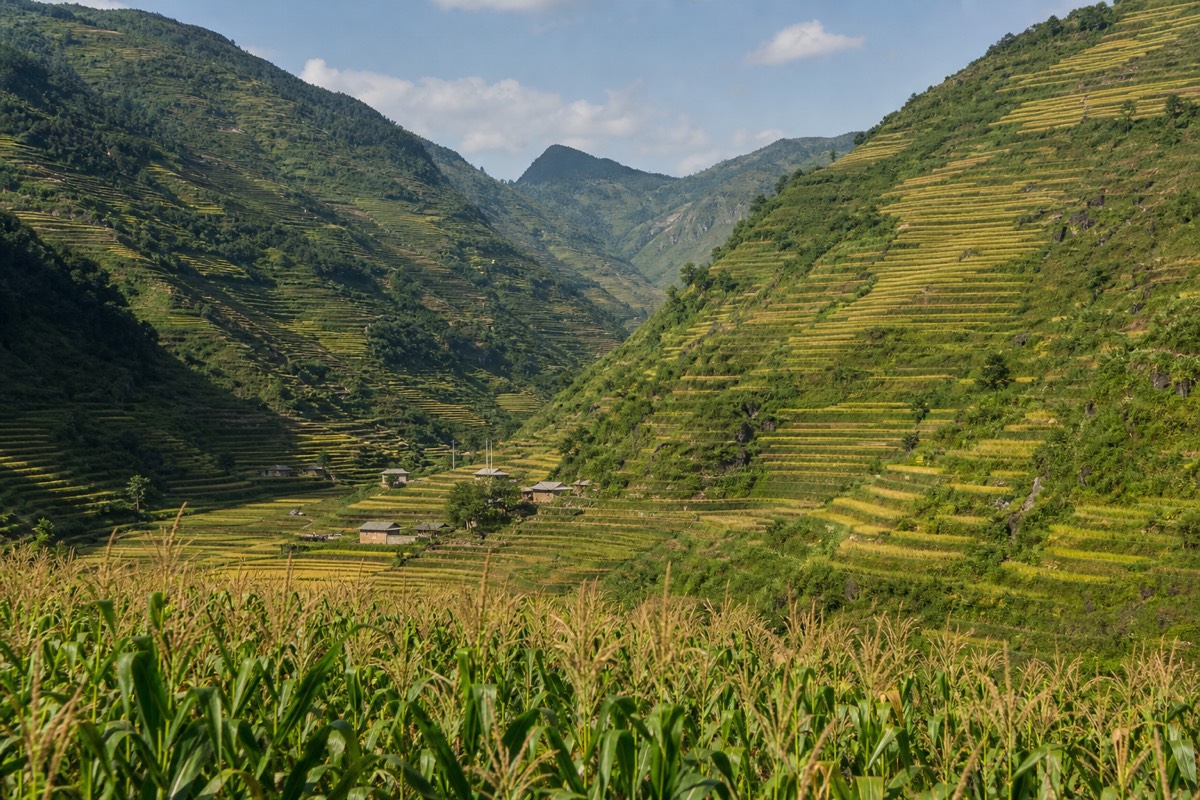
Most of the pass is a gentle, winding descent or climb rather than a series of tight switchbacks, so the actual riding is less technical than people expect from photos. The difficulty is less about the turns and more about staying focused on a road with a serious consequence for a moment of inattention. Riders who've done the rest of the loop's rougher gravel sections, covered in our guide to the best stops on the Ha Giang Loop, often say Ma Pi Leng feels easier mechanically but heavier mentally, simply because of what's below.
The Nho Que River and the Boat Trip Below
The Nho Que River runs through the gorge directly beneath Ma Pi Leng Pass, and a short boat trip on its turquoise water, launched from a landing near the base of the pass, is the most common way riders get down to river level for a different angle on the cliffs above. The boats are small, motorized, and run a fixed loop up and down a scenic stretch of the gorge, giving passengers a view straight up at the cliff road they just rode across.
| Detail | What to expect |
|---|---|
| Access point | A landing reached by a side road/steps down from Ma Pi Leng Pass |
| Trip length | Roughly 30-45 minutes on the water |
| Best water color | Dry season (roughly October to April), when the river runs clearer turquoise |
| Why riders add it | Ground-level view of the cliff face and gorge walls, a break from the bike |
Most multi-day loop tours build the boat trip in as an optional add-on rather than a fixed stop, since it costs extra time and a separate ticket. If a gorge-level view matters to you, tell your guide in advance so the day's schedule leaves room for it, since the descent, the ride, and the climb back up can eat close to two hours once you count the walk to the boats.
Where Are the Best Viewpoints and Photo Stops?
The Ma Pi Leng Panorama viewpoint, roughly midway across the pass, is the single most photographed spot, but several smaller pull-offs along the road offer nearly the same view with far fewer people. Because almost every tour and independent rider stops at the same main viewpoint, it can get crowded, especially in the late morning once traffic from Dong Van catches up with traffic coming the other way from Meo Vac.
| Stop | What you get | Crowd level |
|---|---|---|
| Ma Pi Leng Panorama viewpoint | The classic wide gorge shot, small cafe and viewing platform | High, especially mid-morning |
| Unmarked pull-offs before/after the main viewpoint | Nearly identical views, room to actually stand and look | Low |
| The boat landing road | Looking up at the cliff instead of down into the gorge | Moderate |
| Early-morning stretch near the Dong Van end | Soft light, occasional low cloud sitting in the gorge | Low before 8am |
If photos matter to you as much as the ride itself, ask your guide to leave Dong Van early. Crossing the pass in the first hour or two after sunrise means better light, cooler air, and a viewpoint you might have almost to yourself, a genuinely different experience from the same spot at noon.
How Risky Is Ma Pi Leng Pass, Really?
The road surface itself is solid and the riding is not technically difficult, but the combination of sheer drops, limited guardrails, blind curves, and shared traffic with trucks and other tour groups means it deserves full attention, not casual sightseeing while moving. Most incidents on the loop happen from distraction, going too fast for conditions, or riding in fog or rain rather than from the road being inherently unsafe when ridden carefully.
| Risk factor | How to manage it |
|---|---|
| No barrier on drop side | Keep speed moderate, stay away from the outer edge on curves |
| Fog or low cloud | Slow down significantly, use lights, pull over if visibility drops hard |
| Photo-taking while riding | Stop completely at a viewpoint or pull-off, never shoot while moving |
| Oncoming trucks/buses on curves | Hug your own lane, sound horn on blind bends as locals do |
| Riding it on a self-drive rental with no experience | Consider an easy rider or 3 days: private open-air jeep for this section specifically |
If you're an inexperienced rider, this is the one section of the loop where riding pillion behind a professional easy rider, or taking a jeep, is worth genuinely considering even if you've self-driven the rest of the route. Nobody who's crossed it thinks less of a traveler for choosing the safer option here.
When Is the Best Time to Ride It?
October through early November is the single most popular window, when buckwheat flowers bloom across the terraces near the pass and the weather is generally dry and clear, but it's also when Dong Van and Meo Vac accommodation books out weeks in advance and the pass itself is at its most crowded. For a quieter crossing with still-good weather, the shoulder months on either side of that peak are worth considering.
| Period | Conditions | Crowds |
|---|---|---|
| Mid-Oct to early Nov | Buckwheat bloom, generally dry, clear views | Peak, book far ahead |
| Sep, late Nov | Good visibility, cooler, green or golden terraces | Moderate |
| Dec-Feb | Cold, occasional fog and drizzle, especially mornings | Low |
| Mar-Apr | Warming up, decent visibility | Low to moderate |
| May-Aug | Rainy season, landslide risk on the wider loop, humid | Low |
For a full month-by-month breakdown of weather, festivals, and pricing across the whole loop, see the best time to do the Ha Giang Loop. Whatever month you pick, mornings beat afternoons at Ma Pi Leng specifically, since cloud tends to build over the gorge later in the day.
Which Tours Actually Cross Ma Pi Leng Pass?
Any loop tour of two days or longer crosses Ma Pi Leng Pass, since it sits on the fixed route between Dong Van and Meo Vac; shorter single-day tours out of Ha Giang city generally don't reach this far. If seeing this specific stretch of road is the whole reason you're booking a trip, check the itinerary length before you pay, because a 1-day tour simply doesn't cover the distance.
| Tour | Length | Rating |
|---|---|---|
| 3-Day/2-Night Ha Giang Loop with Private Room (Free Hotel Night Before) | 60h | 5 stars, 9,400+ booked |
| Ha Giang Loop: 4D/3N Easyrider 150cc (Small Group + Private Rooms) | 96h | 5 stars, 3,246+ booked |
| Hanoi: 2 or 3-Day Ha Giang Loop Motorbike Tour with Easy Rider | 72h | 4.9 stars, 6,041+ booked |
| 3-Day Ha Giang Loop: Private Jeep Adventure | 4h transfer + 3 days | 5 stars, 2,476+ booked |
4 days: small-group Easy Rider loop put an experienced local driver in control on this exact stretch, which is worth weighing against the safety notes above. 3 days: private open-air jeep cover the same road at a slower, steadier pace with a driver handling the cliff line for you, a solid choice for anyone unsure about riding it themselves.
How Does It Fit Into a Loop Itinerary?
Ma Pi Leng Pass is almost always crossed on the day riders travel from Dong Van to Meo Vac, meaning it lands roughly two-thirds of the way through a standard counterclockwise loop from Ha Giang city. That timing matters, because it means you're crossing the loop's most demanding, most photographed stretch after you've already had a day or two to get comfortable with the roads, the traffic patterns, and your bike or your driver.
Build in extra time on this leg specifically. Where other transfer days on the loop can be rushed without losing much, rushing Ma Pi Leng means missing the viewpoints, skipping the boat trip option, and riding a genuinely spectacular road with your head down. Our full route explained with map and stops lays out exactly where this fits against Quan Ba, Yen Minh, and the rest of the counterclockwise circuit, and pairs well with planning your night in Meo Vac on the far side.